
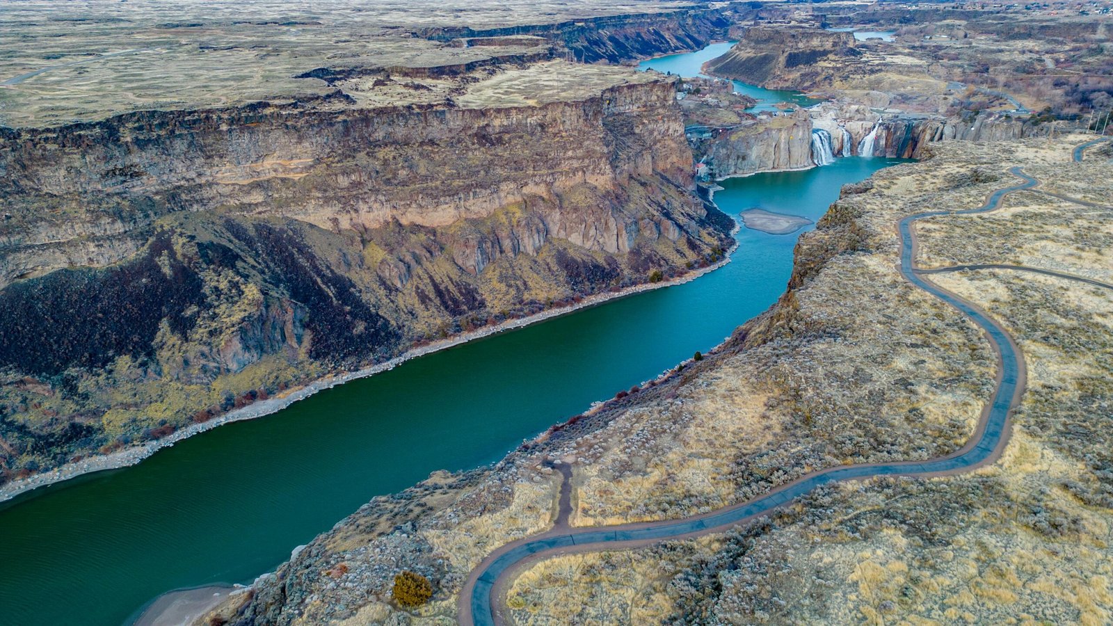
Discover the Nu River (Gyalmo Ngulchu) in Tibet
The Nu River, known internationally as the Salween River, is one of the great rivers of the eastern Tibetan Plateau. Rising in the Tanggula Mountains, the river flows through northern and eastern Tibet before entering Yunnan Province in southwestern China. It then continues through Myanmar and along part of the Myanmar–Thailand border before emptying into the Andaman Sea.
The river has different names along its course. In China, its downstream section is commonly called the Nu Jiang (怒江), while the upper river in Tibet is associated with the Tibetan name Gyalmo Ngulchu (རྒྱལ་མོ་རྔུལ་ཆུ།). In Myanmar, the river is officially known as the Thanlwin. English-language geographical references generally use Salween River for the entire river system.
In Tibet, the river passes through a remarkable variety of landscapes. Its upper reaches cross high-altitude grasslands, wetlands, and broad valleys. Farther downstream, the river cuts through steep mountain ranges and deep canyons, creating dramatic scenery in the Chamdo region and beyond. One of the distinctive scenic locations described in regional sources is Jia Yu Gorge in Lhorong County, where steep cliffs, river crossings, and historical inscriptions form part of the area’s natural and cultural heritage.
For travelers interested in eastern Tibet, the Nu River offers a perspective on the plateau that combines geography, wildlife, Tibetan pastoral culture, Buddhist heritage, and remote mountain landscapes.
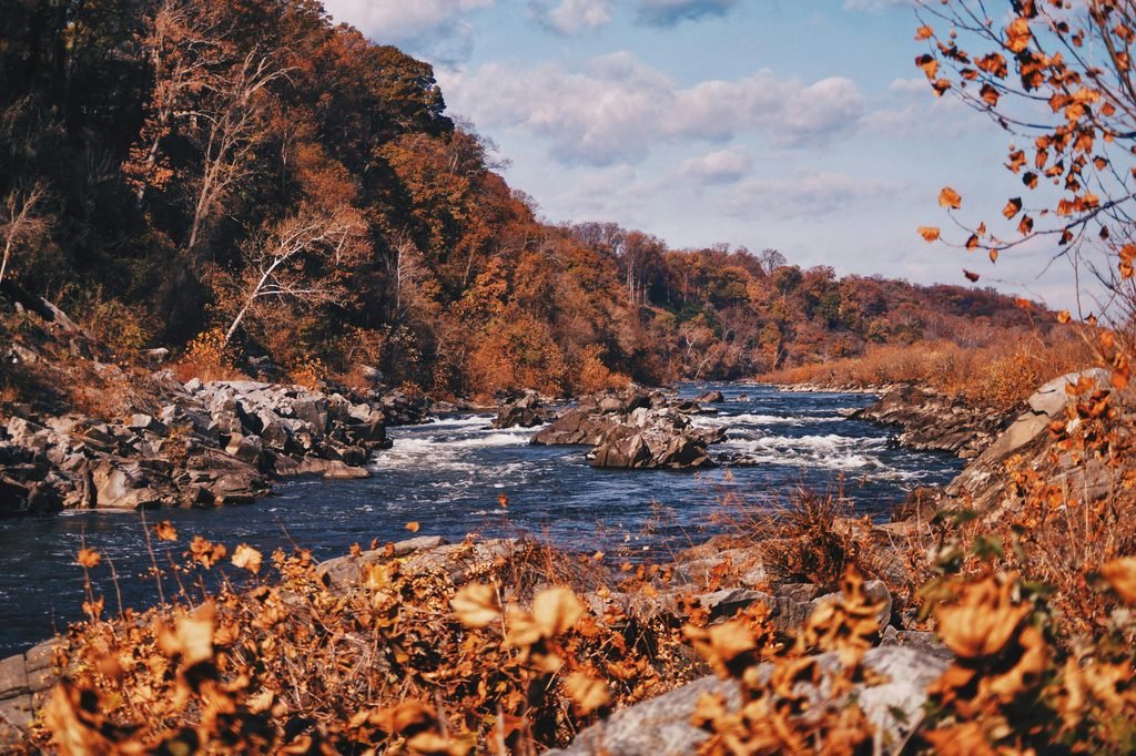
Where Does the Nu River Gyalmo Ngulchu Begin?
The Salween River originates in the Tanggula Mountains on the Tibetan Plateau. Its headwaters lie in a high-altitude region of northern Tibet, near the divide between the river systems that flow toward Southeast Asia.
The source identified in geographical references is near Dengka Peak, east of Tanggula Pass. The Jiangmeiergang Galou Glacier is identified as the highest source, at approximately 5,432 metres above sea level. Headwater streams flow through mountain valleys and collect in Cona Lake before continuing downstream.
From the Tanggula Mountains to the Nagqu River
After leaving Cona Lake, the river continues through the northern Tibetan Plateau. In this region, the upper river is known as Gyalmo Ngulchu, a Tibetan name commonly translated as “Black River.” The river passes through the Nagqu region, where high-altitude grasslands and wetlands form an important part of the surrounding landscape. Tributaries flowing from the southern slopes of the Tanggula Mountains contribute to its water supply.
Farther downstream, the river turns through the mountainous terrain of eastern Tibet and continues toward Yunnan Province. In Yunnan, it is widely known as the Nu River or Nu Jiang.
The Salween River’s International Course
After crossing into Myanmar, the river is called the Thanlwin. It flows south through mountainous areas, including the Shan Hills, and forms part of the international boundary between Myanmar and Thailand before reaching the coastal lowlands. The river eventually empties into the Andaman Sea through the estuary and delta near Mawlamyine, Myanmar.
Key Facts About the Nu River, Gyalmo Ngulchu and Salween River
| Feature | Details |
|---|---|
| International English name | Salween River |
| Chinese name | Nu Jiang (怒江) |
| Tibetan upper-course name | Gyalmo Ngulchu (རྒྱལ་མོ་རྔུལ་ཆུ།) |
| Source region | Tanggula Mountains, Tibetan Plateau |
| Source elevation | Approximately 5,432 m |
| Length of the entire river | Approximately 3,289 km |
| Total drainage basin | Approximately 283,500 km² |
| Main regions in China | Tibet Autonomous Region and Yunnan Province |
| Countries along its course | China, Myanmar, and Thailand |
| Name in Myanmar | Thanlwin River |
| Destination | Andaman Sea, via the Gulf of Martaban |
Note: These figures refer to the Salween River as a whole, not just its section in Tibet. The river’s measured length and source definitions can vary between geographical references.
The Three Landscapes of the Nu River, Gyalmo Ngulchu
The Nu River changes considerably as it travels from the high Tibetan Plateau toward the lower elevations of southwestern China and Myanmar. Its upper, middle, and lower sections feature distinct landscapes shaped by altitude, geology, climate, and river erosion.
The Upper Nu River Gyalmo Ngulchu: Grasslands, Lakes, and Wetlands
The upper river flows through the expansive landscapes of northern Tibet, where broad valleys and open grasslands dominate the scenery. Around Nagqu, the environment includes high-altitude pastures, wetlands, marshes, and lakes. In some sections, the river divides into multiple channels across relatively flat terrain. Seasonal variations in water levels influence the surrounding grasslands and wetland habitats.
During summer, the meadows can become green, creating a striking contrast with the blue sky and distant mountains. Yaks and sheep graze across the pastures, reflecting the importance of pastoral in northern Tibet. The region is also associated with traditional Tibetan horsemanship and seasonal cultural gatherings. Nagqu is a significant regional center and a useful starting point for exploring the grasslands and high-altitude landscapes.
The Middle Nu River: Mountains and Deep Valleys
Farther southeast, the river enters increasingly rugged terrain. Mountain ranges constrain its course, and the valley gradually narrows as the river cuts through resistant rock formations.
In eastern Tibet, the river basin includes steep slopes, forested sections, rocky ridges, and remote settlements. The landscape becomes more dramatic where tributaries enter the main river and the valley drops rapidly in elevation.
These geographical conditions have influenced settlement patterns and transport routes. Communities often developed on available terraces or gentler slopes, while roads and bridges had to negotiate the steep river valleys.
The Lower Nu River: The Great Canyons
In Yunnan Province, the river passes through the Hengduan Mountains, a region known for closely spaced mountain ranges and deeply incised river valleys.
Here, the Salween flows between steep mountain slopes and through spectacular gorges. The river is part of the broader Three Parallel Rivers region, where the Salween, Mekong, and upper Yangtze river systems flow through neighboring mountain corridors. Much of the Salween valley in Yunnan is associated with the Three Parallel Rivers of Yunnan Protected Areas, a UNESCO World Heritage Site.
The steep terrain and strong river flow have created deep canyons, exposed rock faces, and narrow passages. These landscapes illustrate the powerful role of erosion in shaping the mountains of southwestern China.
3. Jia Yu Gorge: A Dramatic Canyon in Lhorong County
Jia Yu Gorge is described in the supplied regional source as a notable scenic landmark along the Nu River, Gyalmo Ngulchu, in Lhorong County, eastern Tibet.
The gorge is associated with steep cliffs, narrow passages, and dramatic views of the river below. Regional descriptions give its length as approximately 27 kilometers, although this measurement should be verified against a reliable local geographical source before being used as a definitive statistic.
The narrow canyon creates a striking contrast between the rushing river and the high rock walls on either side. Its landscape reflects the rugged terrain that makes travel through parts of eastern Tibet challenging.
Jia Yu Bridge
Jia Yu Bridge is a notable river crossing associated with the gorge. Bridges are particularly important in this region because deep valleys and fast-flowing rivers can make overland travel difficult.
The bridge illustrates the relationship between natural geography and transport infrastructure in eastern Tibet. River crossings connect settlements and help travelers navigate terrain where alternative routes may require long detours.
Visitors hoping to see Jia Yu Bridge should confirm its current location, road access, and local visitor arrangements before traveling.
Rock Inscriptions and Historical Heritage
The supplied source also describes Chinese poetic inscriptions carved into the rock walls of Jia Yu Gorge. These inscriptions are presented as part of the area’s historical interest, alongside the dramatic canyon scenery.
Their precise dates and historical context require independent verification. If accessible, the inscriptions may offer an additional perspective on how travelers and writers experienced the gorge in earlier periods.
Together, the canyon, bridge, and reported inscriptions make Jia Yu Gorge a potentially interesting destination for visitors interested in both natural landscapes and local history.
4. Wildlife and Ecosystems of the Nu River Gyalmo Ngulchu Basin
The Salween River basin supports a wide range of habitats because it extends from cold, high-altitude mountain environments to subtropical and tropical landscapes.
Differences in elevation, temperature, rainfall, and river flow influence the plants and animals found along its course.
Freshwater Habitats
The river supports freshwater ecosystems, including fish adapted to flowing water and mountain environments. The species present vary between the upper river, deep mountain valleys, and lower reaches.
In the Tibetan section, cold water, high elevation, and seasonal changes create different ecological conditions from those found farther downstream in Yunnan and Myanmar.
Grasslands and Wetlands
The upper basin contains grasslands, marshes, and wetlands that provide habitat for wildlife and support traditional livestock grazing.
These environments are sensitive to changes in temperature, precipitation, and water availability. Responsible travel helps reduce disturbance to fragile habitats.
Mountain Forests and Biodiversity
Farther south, the warmer and wetter mountain valleys support forests and more varied vegetation. The Salween basin is recognized for its ecological diversity, partly because of its wide range of elevations and relative geographical isolation.
The river corridor connects high mountain ecosystems with lower-elevation habitats, making it important for understanding the biodiversity of the eastern Tibetan Plateau and the Hengduan Mountains.
Cultural and Scenic Attractions Along the Nu River, Gyalmo Ngulchu
The wider Nu River region includes destinations associated with Tibetan pastoral culture, Buddhist traditions, historic transport routes, and mountain scenery.
The following locations are drawn from the supplied article. Their exact access conditions and suitability for tourism should be checked locally.
Nagqu and Tibetan Pastoral Culture
Nagqu is an important regional center in northern Tibet, surrounded by high-altitude grasslands and pastoral landscapes.
The area is associated with traditional Tibetan horsemanship, livestock herding, and seasonal gatherings. The Qiangtang Kyagqen Horse Racing Festival is described in regional tourism material as a celebration of equestrian skills and pastoral culture.
Summer is often an attractive time to experience the grasslands, when vegetation is greener and cultural events may take place. Festival dates and access arrangements should be confirmed for the intended travel year.
Pengpan Township and Mountain Forests
Pengpan Township is identified in the supplied source as an area associated with forest landscapes in the broader Nu River region.
The forests offer a contrast to the open grasslands of northern Tibet and reflect the changes in vegetation that occur as altitude and local climate vary.
Because remote forested areas may have limited facilities, visitors should check road access and local guidance before planning an excursion.
Zandan Monastery in Sog County
Zandan Monastery (赞丹寺), located in Sog County, is a religious site mentioned in the supplied article.
The monastery represents part of the wider Buddhist heritage of northern Tibet. Visitors interested in Tibetan religious architecture and regional history may wish to investigate its visitor arrangements and accessibility before including it in an itinerary.
Tongka Monastery in Baxoi County
Tongka Monastery (同卡寺) is another religious destination identified in the source material.
The broader Chamdo region contains many monasteries reflecting the history and diversity of Tibetan Buddhism. When visiting religious sites, travelers should respect local customs, follow photography rules, and confirm whether visitor access is permitted.
Meili Snow Mountain and the Wider Hengduan Mountain Region
Meili Snow Mountain, also known as Meili Xue Shan, lies in the wider mountain region near the Tibet–Yunnan boundary, between the Salween and Mekong river systems.
Its snow-covered peaks, forested slopes, and deep valleys are among the most recognizable landscapes of northwestern Yunnan. The mountain region provides useful geographical context for understanding the rugged terrain surrounding the Nu River.
Meili Snow Mountain is part of the wider regional landscape rather than a direct attraction along every section of the Nu River.
6. Best Time to Explore the Nu River Gyalmo Ngulchu Region
The best time to explore the Nu River region depends on the specific destination, altitude, and road conditions.
Summer: Best for the Northern Grasslands
Summer can be an attractive period for visiting the grasslands around Nagqu. The landscape may be greener, and pastoral activities and seasonal cultural events can add interest to a journey.
However, summer weather can also bring rain, changing road conditions, and limited visibility. Travelers should prepare for sudden temperature changes and strong sunlight.
Spring and Autumn: Plan Around Local Conditions
Spring and autumn may offer suitable conditions for some routes through eastern Tibet, but temperatures and precipitation vary significantly between the high plateau and the lower mountain valleys.
The best season for a particular canyon or monastery visit should be assessed using current local weather and road information rather than a single region-wide recommendation.
Practical Travel Checklist
Before traveling, check:
- Current road and bridge conditions.
- Weather forecasts for mountain passes and river valleys.
- Local opening arrangements and access restrictions for monasteries and scenic areas.
- Required permits and travel arrangements for foreign visitors to Tibet.
- Driving times, altitude changes, and opportunities to rest.
Remote mountain roads can be narrow and winding. Allow extra time for delays and avoid planning an itinerary that depends on reaching every destination at a fixed hour.
Responsible Travel Along the Nu River, Gyalmo Ngulchu
The Nu River basin contains fragile grasslands, wetlands, forests, and steep mountain environments. Responsible travel helps protect these landscapes and respects the communities that live along the river.
Visitors can help by following these principles:
- Avoid littering and carry waste out of remote areas.
- Respect livestock, wildlife, and local land-use practices.
- Follow local guidance when visiting monasteries and religious sites.
- Ask permission before photographing people or private property.
- Use experienced drivers familiar with mountain roads.
- Check local conditions before entering remote valleys or forest areas.
Travel through the Nu River region is also an opportunity to learn about the lives of Tibetan pastorals, farmers, monks, and other local residents. Understanding these communities adds cultural depth to the experience of the river’s landscapes.
Frequently Asked Questions About the Nu River, Gyalmo Ngulchu
Is the Nu River the same as the Salween River?
Yes. The Nu River, or Nu Jiang (怒江), is the name commonly used in China for the river’s course through Yunnan. Salween River is the common English name for the entire river system, while Thanlwin is its name in Myanmar. In Tibet, the upper river is associated with the Tibetan name Gyalmo Ngulchu.
Where does the Salween River originate?
The Salween River originates in the Tanggula Mountains on the Tibetan Plateau. Geographical references identify its headwaters near Dengka Peak, east of Tanggula Pass, with the Jiangmeiergang Galou Glacier identified as the highest source. The river’s headwaters streams collect in Cona Lake before flowing downstream.
How long is the Salween River?
The Salween River is approximately 3,289 kilometers long according to a commonly cited geographical measurement. The figure describes the entire river, not just the Tibetan section. Other sources may give different measurements depending on how the source and river course are defined.
Which countries does the Salween River flow through?
The Salween River flows through China and Myanmar and forms part of the border between Myanmar and Thailand. It eventually reaches the Andaman Sea near Mawlamyine in Myanmar.
What is Jia Yu Gorge famous for?
Jia Yu Gorge in Lhorong County is described in regional source material for its steep cliffs, narrow canyon scenery, Jia Yu Bridge, and reported rock inscriptions. Its quoted length of approximately 27 kilometers requires independent confirmation.
What can travelers see along the Nu River in Tibet?
Potential highlights include the grasslands around Nagqu, mountain and river scenery in eastern Tibet, Jia Yu Gorge, and Tibetan Buddhist monasteries mentioned in regional tourism sources. Visitors should verify the location, accessibility, and current visitor arrangements for individual sites.
When is the best time to visit the Nu River Gyalmo Ngulchu region?
Summer can be attractive for the grasslands around Nagqu, while the most suitable season for mountain valleys and canyon routes depends on local weather, road conditions, and altitude. Check conditions before traveling.
Conclusion: Explore the Nu River’s Gyalmo Ngulchu Hidden Landscapes
The Nu River Gyalmo Ngulchu in Tibet is part of the upper Salween River system, one of the great waterways connecting the Tibetan Plateau with southwestern China and mainland Southeast Asia.
Its upper reaches cross high-altitude grasslands and wetlands, while farther downstream the river cuts through steep mountains and deep gorges. The landscape reflects the combined influence of geological processes, changing elevation, and the river’s long course through the mountains.
Jia Yu Gorge, as described in regional source material, offers an example of the dramatic canyon scenery associated with eastern Tibet. Monasteries, pastoral communities, and traditional settlements add cultural interest to the wider river basin.
For travelers seeking to understand Tibet beyond its best-known destinations, the Nu River region offers a compelling combination of highland landscapes, Tibetan culture, and rugged mountain geography.



[…] Nujiang 72 Bends: One of the Route’s Most Famous Road Sections […]