
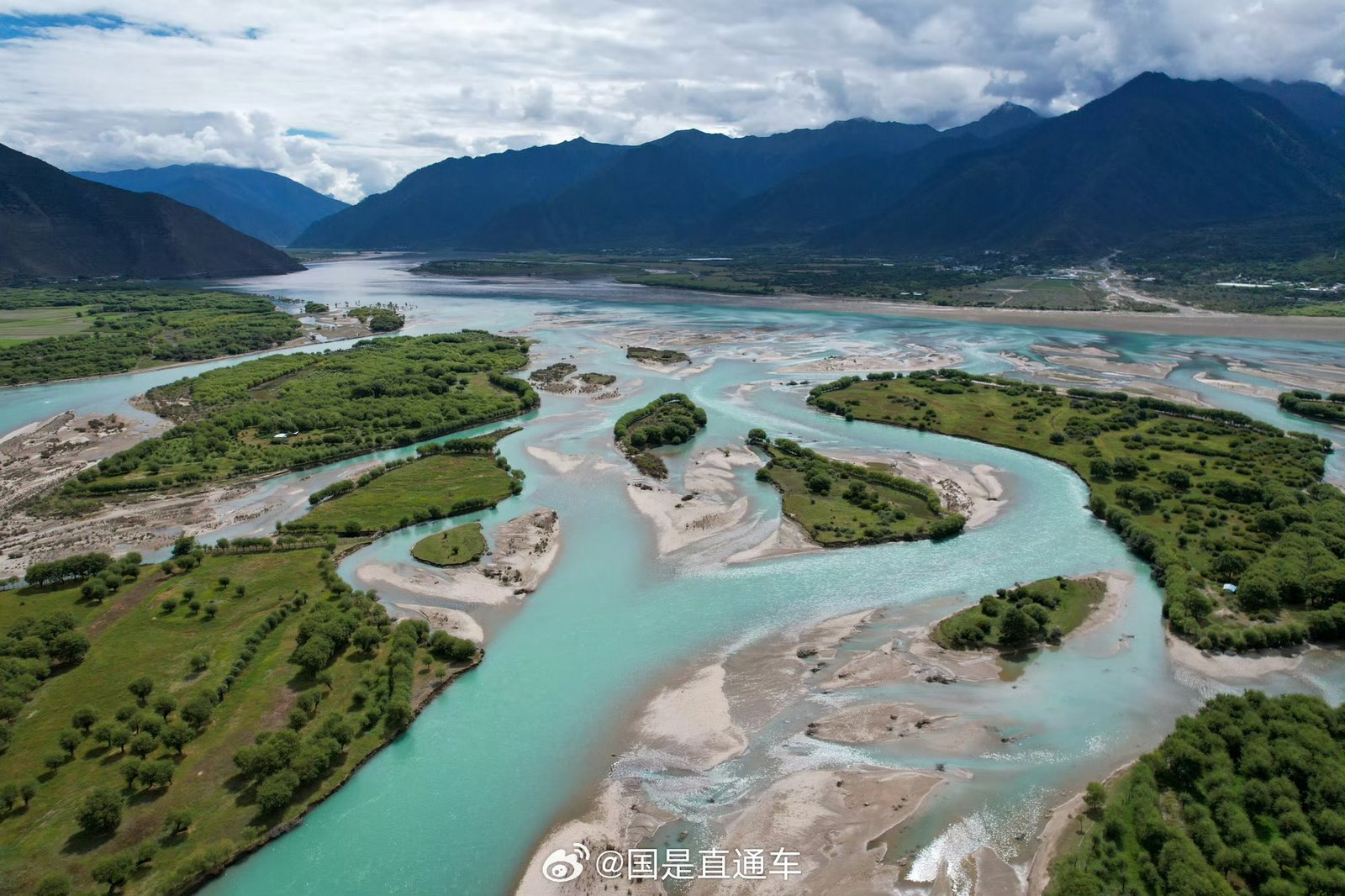
The Lancang River, Upper Course of the Mekong
The Lancang River (Lancang Jiang, 澜沧江) is one of the major rivers of southwestern China and the upper course of the Mekong River, one of Asia’s most important international waterways. Originating on the Tibetan Plateau in Qinghai Province, the river flows through the Tibet Autonomous Region and Yunnan Province before continuing into mainland Southeast Asia.
In eastern Tibet, the Lancang River is especially notable for its deep gorges, steep mountain slopes, winding valleys, and river terraces. Its course passes through the Chamdo region, where dramatic natural landscapes meet traditional Tibetan settlements, historic Buddhist monasteries, and important archaeological sites.
The river is also part of a much larger geographical system connecting the Tibetan Plateau with communities and ecosystems across China, Myanmar, Laos, Thailand, Cambodia, and Vietnam. Downstream, it supports agriculture, fisheries, transportation, and livelihoods across the Mekong basin.
For travelers interested in Tibet’s geography, culture, and less-visited destinations, the Lancang River valley offers a different perspective on the eastern Tibetan Plateau.
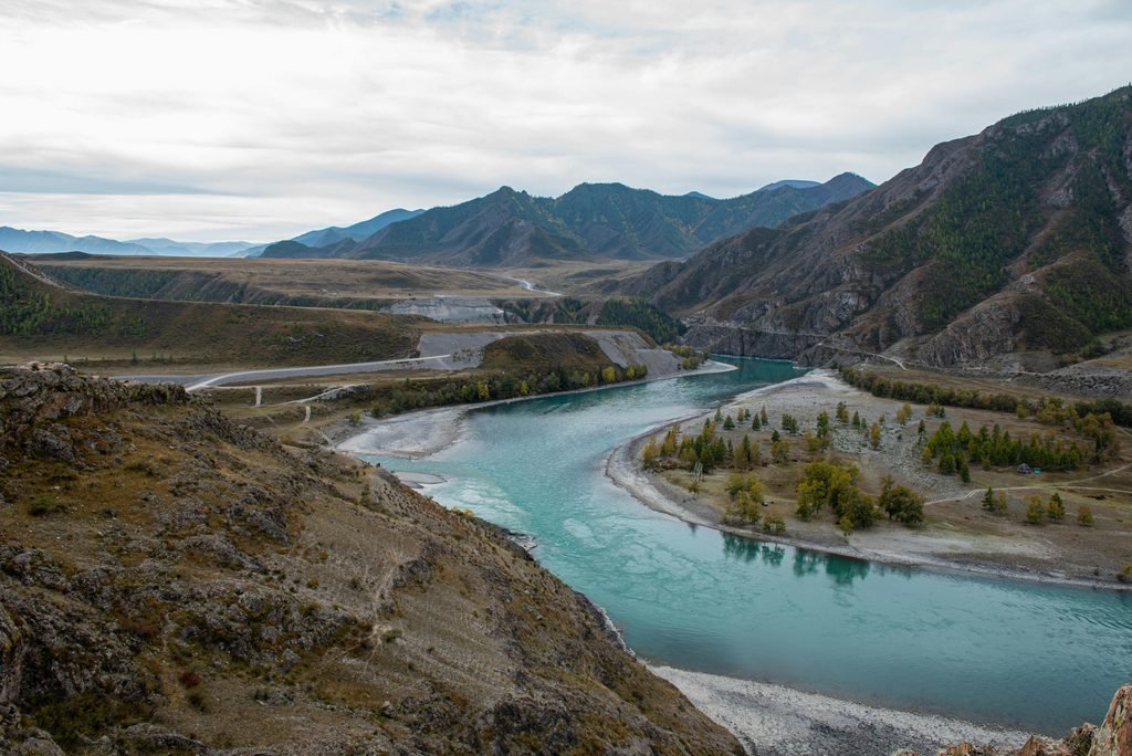
Where Does the Lancang River Begin?
The Mekong River originates on the Tibetan Plateau in Qinghai Province, China. Its source is generally identified as the Lasagongma (Lasaigongma) Spring on Mount Guozongmucha in Zadoi County, within the Sanjiangyuan region.
The river is known as the Za chu (扎曲; Tibetan: རྫ་ཆུ་, Wylie: rDza chu) in its upper reaches. As it flows through eastern Tibet and onward into Yunnan Province, it is known in Chinese as the Lancang Jiang. After leaving China, it becomes internationally known as the Mekong River. The spelling and precise definition of the source can vary among geographical references, so these names should be understood as successive names for the same river system rather than separate rivers.
The river’s course through eastern Tibet
The Lancang River crosses the rugged terrain of the eastern Tibetan Plateau, passing through the Chamdo region before continuing southeast into Yunnan. The surrounding landscape is shaped by the interaction of high mountains, tributaries, erosion, and substantial changes in elevation.
Near Chamdo, the Za Chu joins another major river, commonly identified in regional sources as the Ngomchu or Angqu. The combined waters continue downstream as the Lancang River.
Further south, the river passes through the Markam area, including the vicinity of Yanjing, before entering Yunnan Province. Its valley gradually transitions from the high Tibetan Plateau into the mountainous terrain of the Hengduan Mountains.
Key Facts About the Lancang River and Mekong River
| Feature | Details |
|---|---|
| International river name | Mekong River |
| Chinese name in China | Lancang Jiang (澜沧江) |
| Tibetan upper-course name | Za Qu (扎曲; རྫ་ཆུ་) |
| Source region | Tibetan Plateau, Qinghai Province, China |
| Source locality | Lasagongma Spring, Mount Guozongmucha, Zadoi County |
| Major Tibetan regional center | Chamdo |
| Chinese provinces and regions along the upper course | Qinghai, Tibet Autonomous Region, and Yunnan |
| Countries in the wider river course | China, Myanmar, Laos, Thailand, Cambodia, and Vietnam |
| Approximate total river length | About 4,900 km, depending on the measurement used |
| Drainage basin | Approximately 795,000 km², according to commonly cited estimates |
| Final destination | South China Sea, via the Mekong Delta in Vietnam |
The total length and drainage figures refer to the wider Mekong River system, not just the Lancang section in Tibet. Estimates differ because of variations in source identification and measurement methods.
The Geography of the Lancang River Valley
The Lancang River valley in eastern Tibet is characterized by striking changes in terrain. Some sections contain relatively broad valleys and gently sloping river terraces, while others narrow into deep gorges bordered by steep mountain walls. These contrasting landscapes reflect the river’s long history of erosion, the geological structure of the surrounding mountains, and the powerful effects of flowing water over large differences in elevation.
The upper valley: river terraces and settlements
In the upper part of the Lancang River valley, the river alternates between narrow channels and wider stretches. In selected areas, tributaries create broader valley floors where sediment accumulates and the land becomes more suitable for agriculture and settlement.
Chamdo is an important example. The city developed around river terraces near the meeting point of major rivers. Compared with the surrounding mountain slopes, these terraces provide relatively level ground for homes, roads, farmland, and public facilities. The landscape demonstrates how the availability of flat land influences settlement patterns across eastern Tibet, where steep terrain and high elevations limit the areas suitable for cultivation and construction.
Wider valleys near tributary confluences
Where smaller rivers meet the Lancang, they can deposit sediment and form alluvial fans, terraces, and wider valley floors. Such features are especially important in mountainous regions because they create limited areas of relatively accessible land. These wider sections contrast with the more confined channels farther downstream. Their distribution is closely related to the geology of the valley and the volume of sediment carried by tributaries.
3. The Lower Lancang River: Deep Gorges and Steep Mountain Slopes
As the river continues south through eastern Tibet toward Markam and Yunnan, it cuts through increasingly rugged mountainous terrain. In many places, the valley narrows into deep canyons, with steep slopes rising above the river.
The Lancang forms part of the broader mountainous landscape associated with the Hengduan Mountains, a region known for major rivers running through closely spaced mountain ranges. The Lancang, the Yangtze, and the Salween are particularly important rivers in this geographical setting.
How the gorges formed
The Lancang River has gradually eroded the underlying rock as water flowed downhill through the mountains. Differences in rock type, geological structure, and the resistance of individual rock layers influence the shape of the river channel. Hard rock formations can produce irregular riverbeds and turbulent rapids. Steep gradients and confined channels also increase the river’s erosive power, contributing to the formation of deep valleys.
The resulting scenery includes narrow gorges, exposed rock faces, sharp mountain ridges, and river bends far below surrounding slopes.
Landslides, rockfalls, and debris flows
Mountain slopes beside the Lancang River can be affected by rockfalls, landslides, and debris flows. Heavy rainfall, weathering, steep terrain, and unstable geological materials can all contribute to slope instability. Where tributaries enter the main river, deposited material may form alluvial fans and terraces. These features can provide useful land for local communities, although the same terrain may also be exposed to flooding or slope-related hazards.
For travelers, this geography is an important reason to allow sufficient time for road journeys through eastern Tibet. Weather, road maintenance, landslides, and local restrictions can affect travel conditions.
4. Wildlife, Vegetation, and Agriculture Along the Lancang River
The Lancang River valley supports a variety of habitats shaped by altitude, temperature, rainfall, and terrain. The environment changes considerably between the higher plateau areas and the warmer valleys farther south.
Freshwater habitats
The river system supports freshwater fish and other aquatic organisms adapted to mountain streams and changing water conditions. Fish diversity and distribution vary along the river because water temperature, elevation, flow speed, and habitat structure differ from one section to another.
The river is also part of the much larger Mekong basin, which supports important freshwater ecosystems throughout Southeast Asia.
Mountain vegetation and grasslands
The surrounding slopes support vegetation adapted to local climate and elevation. Dry slopes may have shrubs and grassland, while suitable areas farther south support forests and other mountain vegetation. These differences create a landscape of contrasting habitats within a relatively short geographical distance.
Agriculture and traditional livelihoods
River terraces and wider valley floors are valuable for farming and settlement. In eastern Tibet, where mountains leave relatively little flat land, these areas provide important spaces for cultivating crops, raising livestock, and maintaining transport routes.
The river has therefore influenced not only the natural environment but also the distribution of villages and the development of local livelihoods.
Cultural and Historical Attractions Along the Lancang River
The Lancang River valley is more than a geographical feature. It forms part of the wider cultural landscape of eastern Tibet, particularly the Chamdo region and the historic Kham area.
Visitors can explore Tibetan Buddhist heritage, prehistoric archaeology, distinctive geological formations, and traditional settlements along routes through Chamdo and Markam.
Jampaling Monastery in Chamdo
Jampaling Monastery (强巴林寺), located in Chamdo, is one of the important Tibetan Buddhist monasteries in the Kham region.
Associated with the Gelug school of Tibetan Buddhism, the monastery reflects Chamdo’s longstanding role as a religious and cultural center in eastern Tibet. Its religious buildings and monastic traditions offer visitors an introduction to Tibetan Buddhist architecture and regional religious history.
Travelers exploring Chamdo can include Jampaling Monastery as part of a cultural sightseeing itinerary.
Karuo Archaeological Site
The Karuo archaeological site (卡若遗址), near Chamdo, is an important prehistoric site on the Tibetan Plateau.
Archaeological remains from Karuo provide evidence of early settlement and offer insights into ancient housing, pottery, tools, and subsistence practices. The site helps researchers investigate how communities lived and adapted to the environmental conditions of eastern Tibet thousands of years ago.
Karuo is particularly valuable for understanding the region’s history before the development of later Tibetan political and religious institutions.
Gubu Rong Caves
The Gubu Rong cave system (谷布溶洞) is another geological attraction associated with the broader Chamdo region. The caves illustrate the area’s varied rock formations and underground landscapes.
Descriptions of the cave system’s extent vary, and visitor access may depend on local arrangements. Travelers should confirm current accessibility before adding the caves to an itinerary.
Yanjing: River Scenery and Traditional Salt Production
Yanjing, in Markam County, lies along the Lancang River valley near the transition between the Tibetan Plateau and the mountainous terrain of northwestern Yunnan.
The area is known for its dramatic river scenery and traditional salt-producing heritage. Salt production has historically connected local communities with wider trading networks, demonstrating how natural resources and mountain routes influenced economic and cultural exchange.
Yanjing is an interesting stop for travelers seeking to understand the relationship between geography, traditional livelihoods, and the history of eastern Tibet.
How to Explore the Lancang River in Eastern Tibet
For visitors interested in the Lancang River, a journey through Chamdo and Markam offers opportunities to experience its landscapes and cultural heritage.
Places to consider include:
- Chamdo: Visit Jampaling Monastery and explore the regional cultural center.
- Karuo: Learn about prehistoric settlement at the Karuo archaeological site.
- Chaya: Explore the changing landscapes of the river valleys and surrounding mountains.
- Markam: Experience the steep Lancang River gorges and mountain scenery.
- Yanjing: Discover traditional salt production and the historic cultural landscape of the river valley.
Practical travel advice
Eastern Tibet is mountainous, and distances between destinations can translate into long driving days. Travelers should allow flexibility for road conditions, weather, and possible delays.
Before traveling, check local access arrangements for individual attractions and confirm the travel documentation required for your nationality and itinerary. Foreign passport holders visiting the Tibet Autonomous Region generally need to arrange the applicable Tibet Travel Permit through an eligible travel agency, with additional permits required for certain restricted areas or routes.
For a more comfortable trip, plan an itinerary that accounts for altitude, driving time, and opportunities to rest rather than attempting to cover too many destinations in a short period.
7. Frequently Asked Questions About the Lancang River
Is the Lancang River the same as the Mekong River?
Yes. The Lancang River is the Chinese name used for the upper course of the Mekong in China. The river flows through the Tibet Autonomous Region and Yunnan Province before continuing into mainland Southeast Asia, where it is generally called the Mekong River.
Where does the Mekong River originate?
The Mekong originates on the Tibetan Plateau in Qinghai Province, China. Its source is commonly identified as Lasagongma Spring on Mount Guozongmucha in Zadoi County. The river begins as the Za Qu and is later known as the Lancang Jiang in China.
How long is the Mekong River?
The Mekong is approximately 4,900 km long according to commonly cited measurements. Some references give different totals because of differences in source identification and measurement methods. This figure describes the wider river system, not only the section in Tibet.
Which countries does the Mekong River flow through?
The Mekong river system extends through China, Myanmar, Laos, Thailand, Cambodia, and Vietnam. The river crosses some countries and forms sections of international borders in others.
What makes the Lancang River valley distinctive?
The valley is known for its steep mountain slopes, deep gorges, rapidly changing elevation, river terraces, and varied habitats. It also contains historic settlements and cultural sites that reflect the long relationship between communities and the river.
What are the main attractions near the Lancang River in Tibet?
Notable places in the broader region include Jampaling Monastery, the Karuo archaeological site, the Gubu Rong caves, and Yanjing. Together, they offer opportunities to explore Tibetan Buddhist heritage, prehistoric archaeology, geological formations, and traditional salt production.
Can tourists visit the source of the Mekong River?
The source lies in a remote area of Qinghai Province on the Tibetan Plateau, rather than near Chamdo in the Tibet Autonomous Region. Access may be restricted by conservation measures and local regulations, so travelers should verify current access conditions before planning a visit.
Conclusion: Discover the Lancang River in Tibet
The Lancang River is one of the defining geographical features of eastern Tibet and the upper course of the Mekong River. From its headwaters on the Tibetan Plateau to the deep gorges of Chamdo and Markam, it reveals the powerful influence of water, geology, and elevation on the region’s landscape.
Its river terraces support settlements and agriculture, while its surrounding mountains contain diverse habitats and dramatic scenery. Cultural landmarks such as Jampaling Monastery and the Karuo archaeological site provide additional insight into the religious and historical heritage of eastern Tibet.
For travelers interested in Tibet beyond its best-known destinations, the Lancang River valley offers a compelling combination of natural landscapes, local history, and traditional culture.



[…] Lancang River Valley: Mountains, Villages, and Deep […]