Tibet is known as the Roof of the World, and its high-altitude landscapes are among the most remarkable in Asia. From the historic streets of Lhasa to the shores of Namtso Lake, the Everest region and the sacred Mount Kailash pilgrimage route, many of Tibet’s most popular destinations are located thousands of metres above sea level.
Altitude is an important part of planning a Tibet trip. A journey that looks short on a map may involve a significant increase in elevation, while a scenic viewpoint may be much higher than the town where you spend the night. Understanding the altitude of each destination helps travelers prepare for thinner air, plan appropriate rest days and reduce the risk of altitude sickness.
This guide lists approximate elevations for major tourist destinations in Tibet and explains how to use them when planning your itinerary.
How high is Tibet? Altitude Guide
Much of the Tibetan Plateau lies above 4,000 metres, although elevations vary considerably between valleys, towns, lakes and mountain passes. Lhasa, the main gateway for many international visitors, is approximately 3,650–3,700 metres above sea level. Western Tibet is generally higher, with destinations such as Saga, Darchen and the Mount Kailash kora route reaching elevations above 4,500 metres.
The Tibet-side Everest visitor area is approximately 5,000–5,200 metres, while Dolma La Pass on the Mount Kailash kora is around 5,630 metres. At these elevations, lower atmospheric pressure reduces the amount of oxygen available with each breath. Visitors arriving from low-altitude regions need time to acclimatize.
Elevation of major Tibet tourist destinations
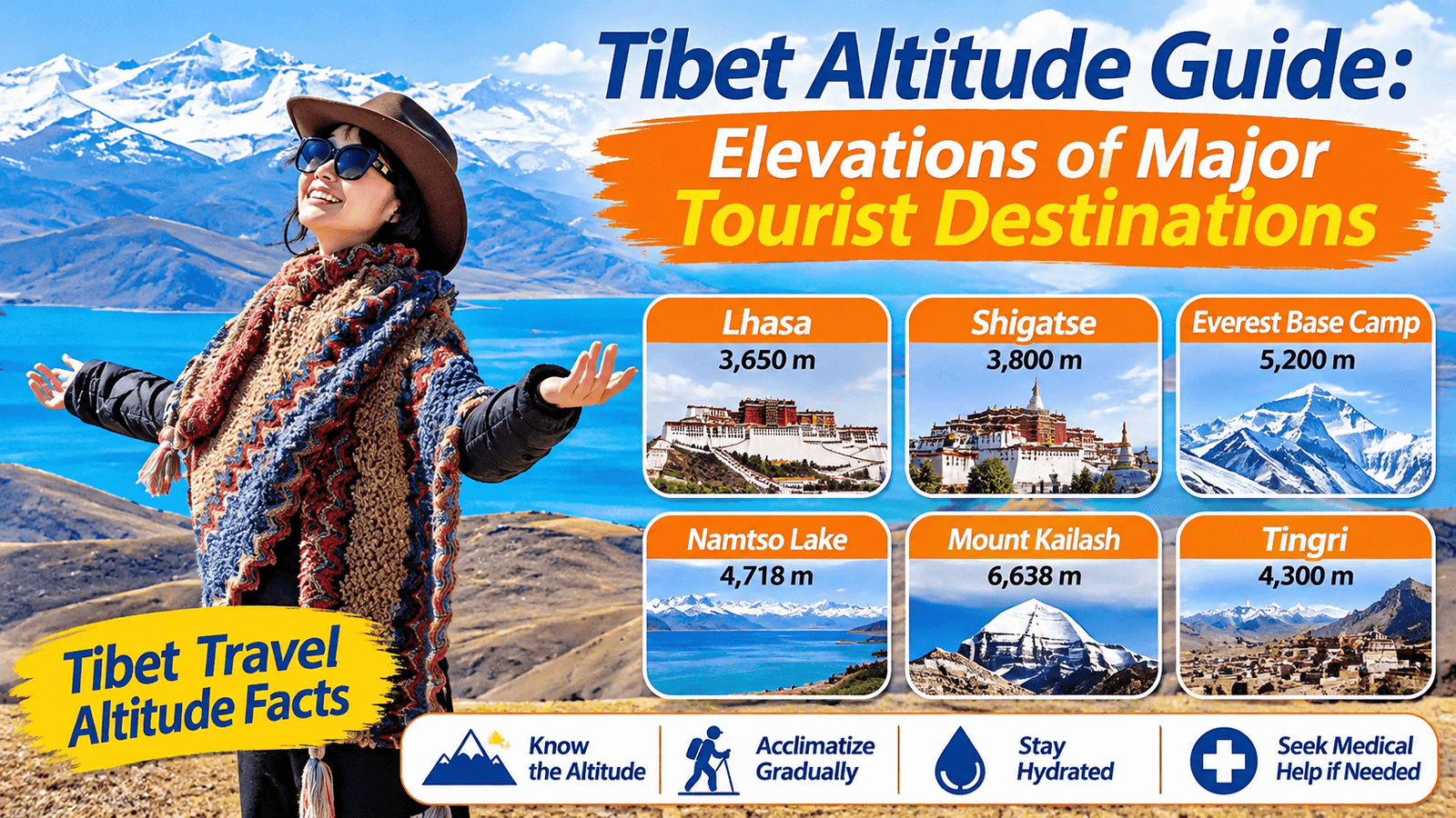
The following table provides approximate elevations for popular places included in Tibet tours. Figures are intended for travel planning rather than precise surveying.
| Destination | Approximate elevation |
|---|---|
| Gyirong / Kyirong town | 2,700–2,800 m |
| Nyingchi | Around 3,000 m |
| Chamdo | Around 3,200 m |
| Tsedang | Around 3,550–3,600 m |
| Lhasa | 3,650–3,700 m |
| Shigatse | 3,850–3,900 m |
| Gyantse | Around 4,000 m |
| Guge Kingdom / Zanda area | Around 3,800–3,900 m |
| Tingri | Around 4,300 m |
| Yamdrok Lake viewpoints | Around 4,400–5,000 m |
| Saga | Around 4,500–4,650 m |
| Lake Manasarovar | Around 4,590 m |
| Darchen | Around 4,670 m |
| Namtso Lake | Around 4,700–4,800 m |
| Rongbuk Monastery area | Around 5,000 m |
| Tibet Everest visitor area | Around 5,000–5,200 m |
| Dolma La Pass | Around 5,630 m |
Important: These elevations are approximate. A destination may cover a large area, and the altitude of a town, hotel, lake shore, mountain pass or viewpoint can differ. Road routes and accommodation locations may also change. Confirm the actual overnight elevations for your planned itinerary.
Altitude Guide of popular Tibet travel routes
A useful way to understand Tibet’s elevation is to look at the altitude changes along common travel routes.
1. Lhasa city tour
<text> </text>
| Attraction | Approximate elevation |
|---|---|
| Jokhang Temple | Around 3,650 m |
| Barkhor Street | Around 3,650 m |
| Potala Palace | Around 3,650–3,700 m |
| Norbulingka | Around 3,650 m |
| Sera Monastery | Around 3,700 m |
| Drepung Monastery | Around 3,800 m |
| Ganden Monastery | Around 3,800 m |
| Drak Yerpa | Around 4,300–4,400 m |
Most central Lhasa attractions are at similar elevations. However, visits to monasteries and hillside sites can involve climbing, stairs and walking uphill. Drak Yerpa is substantially higher than central Lhasa and should be treated as a higher-altitude excursion.
2. Lhasa to Everest Base Camp
The route from Lhasa to the Tibet-side Everest region gradually moves west and climbs toward the Himalayas.
| Route stop | Approximate elevation |
|---|---|
| Lhasa | 3,650–3,700 m |
| Shigatse | 3,850–3,900 m |
| Tingri | Around 4,300 m |
| Rongbuk area | Around 5,000 m |
| Everest visitor area | Around 5,000–5,200 m |
The overnight altitude matters more than the highest point visited during a short daytime stop. A well-planned route should allow time for acclimatization before sleeping near Everest.
3. Lhasa to Mount Kailash and Lake Manasarovar
The journey to western Tibet involves several high-altitude stages.
| Route stop | Approximate elevation |
|---|---|
| Lhasa | 3,650–3,700 m |
| Shigatse | 3,850–3,900 m |
| Saga | Around 4,500–4,650 m |
| Lake Manasarovar | Around 4,590 m |
| Darchen | Around 4,670 m |
| Dirapuk area | Around 4,900–5,200 m |
| Dolma La Pass | Around 5,630 m |
| Zutulpuk area | Around 4,800 m |
The Mount Kailash kora is a demanding high-altitude pilgrimage. Travelers should allow time to acclimatize before starting and should not begin the walk while experiencing altitude sickness symptoms.
4. Lhasa to Namtso Lake
Namtso is one of Tibet’s most famous high-altitude lakes. The lake is approximately 4,700–4,800 metres above sea level, depending on the location.
The road journey from Lhasa crosses higher terrain before reaching the lake area. The Nyenchen Tanglha mountain region and the surrounding passes also involve substantial elevation changes.
A day visit can still be physically demanding, even if you return to a lower sleeping altitude in Lhasa. Travelers should walk slowly, avoid unnecessary exertion and pay attention to symptoms.
5. Lhasa to Yamdrok Lake
Yamdrok Lake is a popular excursion from Lhasa. Its viewpoints are generally much higher than central Lhasa.
The well-known Gangbala Pass viewpoint is approximately 4,800–5,000 metres, while other lakeside and roadside locations are lower. The exact elevation depends on the stop.
Visitors may experience breathlessness or fatigue while walking at the viewpoints. Keep visits relaxed, especially if you have only recently arrived in Tibet.
Why does Altitude Guide matter when planning a Tibet tour?
Altitude affects the body through reduced atmospheric pressure and lower oxygen availability. The higher you go, the more important acclimatization becomes.
Three factors are especially important.
1. Sleeping altitude
The elevation where you sleep is particularly important for altitude illness risk.
A traveler may visit a high mountain pass during the day and return to a lower hotel at night. This is generally less demanding than sleeping at the same high elevation.
When comparing two itineraries, check the overnight stops rather than looking only at the highest sightseeing point.
2. Rate of ascent
A rapid increase in sleeping altitude gives the body less time to adjust.
General high-altitude travel guidance recommends avoiding a direct ascent from low altitude to a sleeping elevation above approximately 2,750 metres in one day. Once above 3,000 metres, a commonly used recommendation is to increase sleeping altitude by no more than approximately 500 metres per day and add an extra acclimatization night for every additional 1,000 metres of sleeping-altitude gain.
These are general guidelines, not guarantees. Some travelers need a slower ascent.
3. Individual susceptibility
People respond differently to altitude. Previous experience at a similar elevation and ascent rate can provide useful information, but it cannot guarantee how someone will respond on a future trip.
Physical fitness does not prevent altitude sickness. Travelers should plan around acclimatization rather than assuming that regular exercise will protect them.
How to use Altitude Guide information when choosing a Tibet itinerary
A good Tibet itinerary should balance sightseeing, driving time, overnight elevation and rest.
For example, a Lhasa city tour gives visitors time at approximately 3,650–3,700 metres before continuing to higher destinations.
An Everest itinerary should consider the progression from Lhasa to Shigatse, Tingri and the Everest region. A Mount Kailash itinerary should consider the higher sleeping elevations around Saga and Darchen before the kora.
When reviewing an itinerary, ask your travel agency:
- What is the approximate elevation of each overnight hotel?
- How much does the sleeping altitude increase each day?
- Are there rest or acclimatization days?
- What happens if a traveler develops altitude sickness?
- How will emergency descent or evacuation be arranged?
- Is oxygen available, and what type of equipment is provided?
Do not judge a route only by the number of days or kilometres. A slightly longer itinerary may be more comfortable and safer if it provides better acclimatization opportunities.
Symptoms of altitude sickness to watch for
Altitude sickness can develop after reaching a higher elevation, often within hours or during the first night.
Common symptoms of acute mountain sickness (AMS) include:
- Headache
- Nausea or reduced appetite
- Dizziness
- Unusual fatigue
- Difficulty sleeping
More serious warning signs include breathlessness at rest, a worsening cough, confusion, loss of coordination or reduced consciousness.
Do not ascend to sleep at a higher altitude while experiencing altitude sickness symptoms. If symptoms worsen despite rest or treatment, descent is necessary. Suspected HAPE or HACE requires urgent medical assistance and descent.
A pulse oximeter can help monitor oxygen saturation, but a single reading cannot diagnose or rule out altitude illness.
Frequently asked questions
What is the highest tourist destination in Tibet?
The Tibet-side Everest visitor area is around 5,000–5,200 metres, while Dolma La Pass on the Mount Kailash kora is around 5,630 metres. The exact highest point depends on the itinerary and activities.
Is Lhasa higher than Namtso Lake?
No. Lhasa is approximately 3,650–3,700 metres, while Namtso Lake is around 4,700–4,800 metres.
What is the altitude of Mount Kailash?
Mount Kailash’s summit is approximately 6,638 metres. Pilgrims do not climb the summit during the traditional outer kora. The route’s highest point, Dolma La Pass, is around 5,630 metres.
What is the altitude of Everest Base Camp in Tibet?
The visitor area around Rongbuk and Tibet’s Everest Base Camp tourist zone is approximately 5,000–5,200 metres, depending on the precise location.
Is Yamdrok Lake higher than Lhasa?
Yes. Popular Yamdrok viewpoints are generally around 4,400 metres or higher, with some well-known pass viewpoints approaching 5,000 metres.
Does visiting a high-altitude place during the day cause altitude sickness?
Day visits still expose the body to thinner air and can cause symptoms, especially if the visit involves strenuous activity. Returning to a lower sleeping altitude generally reduces the physiological stress compared with sleeping at the higher elevation.
Can I travel to Tibet if I have never been to high altitude?
Many travelers visit Tibet without previous high-altitude experience, but they should plan a gradual ascent, allow time for acclimatization and understand the symptoms of altitude illness. People with relevant medical conditions should consult a doctor before traveling.
Final advice for Altitude Guide
Tibet’s landscapes are extraordinary, but the elevation changes are a major part of the travel experience. Lhasa, Namtso, Everest Base Camp and Mount Kailash all have different altitude demands.
Use elevation information to compare routes, check overnight stops and plan acclimatization. A well-designed journey should allow you to enjoy Tibet without rushing your body to adapt.
Medical disclaimer: This article provides general travel-health information and is not a substitute for professional medical advice, diagnosis or treatment. Consult a healthcare professional familiar with high-altitude medicine if you have underlying medical conditions or a history of altitude illness.
Suggested internal links
- Altitude Sickness in Tibet: Complete Guide for Travelers
- How to Prevent Altitude Sickness: Acclimatization and Travel Planning
- Altitude Sickness in Lhasa: Elevation, Symptoms and Acclimatization
- Altitude Sickness at Everest Base Camp: Risks and Safety Advice
- Altitude Sickness on the Mount Kailash Pilgrimage
- Blood Oxygen Levels at High Altitude: SpO₂ Guide for Travelers
References
- CDC Yellow Book 2026, High-Altitude Travel and Altitude Illness.
- CDC Travelers’ Health, Travel to High Altitudes.
- Tibet Travel, Lhasa Altitude and Elevation Guide, for approximate destination elevations. Individual elevations should be confirmed against the precise route and accommodation location.