
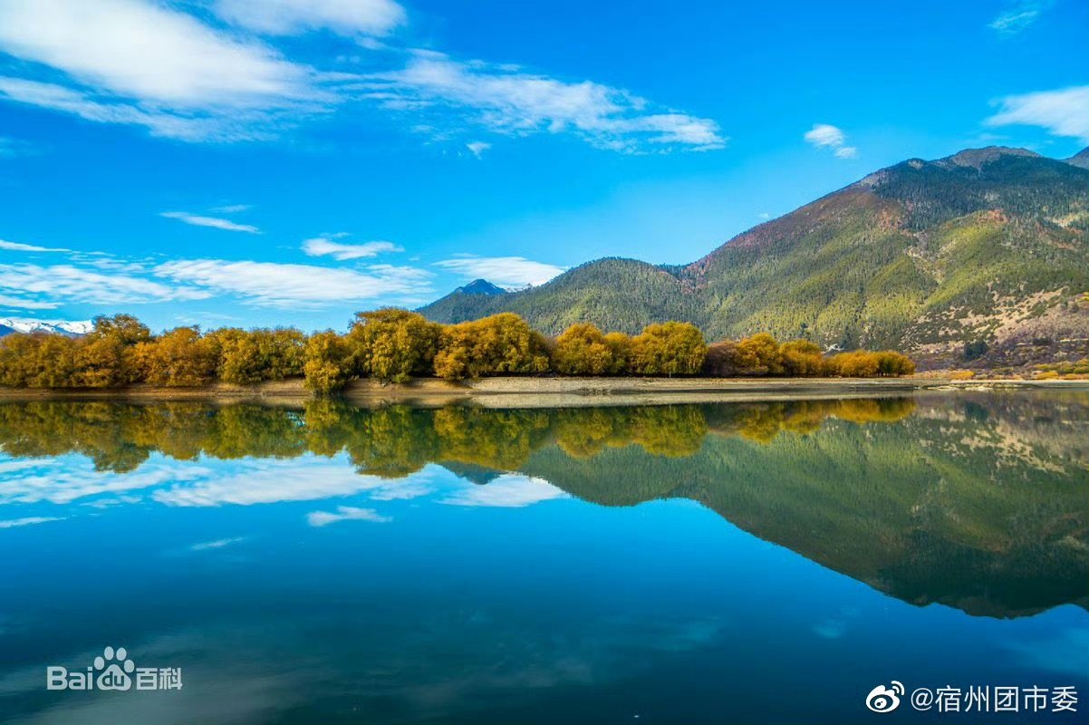
Discover the Nyang River in Nyingchi, Tibet
The Nyang River (Tibetan: ཉང་ཆུ་ Chinese: 尼洋河) is a major river in southeastern Tibet and one of the important tributaries of the Yarlung Tsangpo River. Flowing through the Nyingchi region, it is known for its mountain scenery, river valleys, and close relationship with the area’s settlements and agricultural landscapes.
Also written as the Niyang River, the Nyang River stretches for approximately 307.5 kilometers. It rises in the mountains west of Mila Mountain, flows past Bayi, and eventually joins the Yarlung Tsangpo near Cemeng in Nyingchi. Its course connects high mountain terrain with the greener valleys of southeastern Tibet.
The river is also associated with traditional Tibetan river culture, including the use of lightweight hide boats on some mountain waterways. These craft illustrate how local communities adapted their transportation methods to the challenging conditions of the Tibetan Plateau. For travelers exploring Nyingchi, the Nyang River offers an opportunity to appreciate the region’s distinctive landscapes and learn more about the relationship between Tibetan communities and their natural environment.
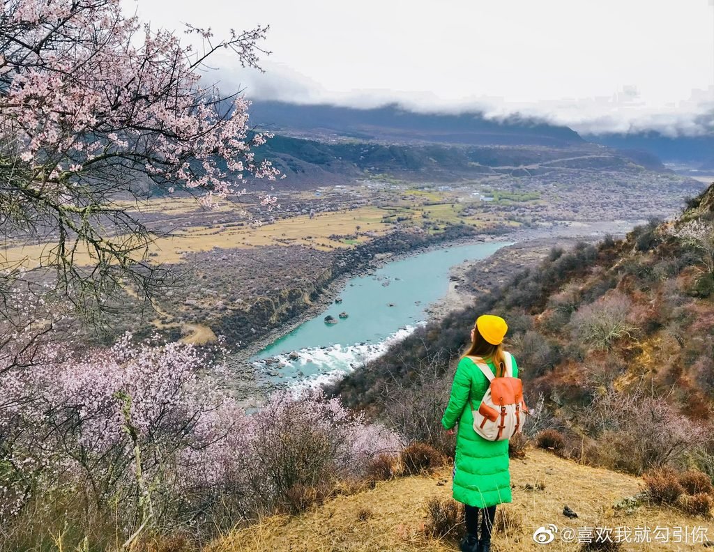
Where Is the Nyang River?
The Nyang River is located in the Tibet Autonomous Region of southwestern China. It flows through Nyingchi, an area known for its mountains, forests, river valleys, and relatively lush landscapes compared with many drier parts of the Tibetan Plateau.
The river originates at approximately 5,000 meters above sea level in the Cuomuliangla area of the Goikarla Rigyu mountain range, west of Mila Mountain. From its high-altitude source, it descends through the region before joining the Yarlung Tsangpo River near Cemeng in Nyingchi. The river passes the town of Bayi, the main urban center of Nyingchi, where the waterway is crossed by the Bayi Zanchen Bridge.
Nyang River: Key Facts
| Feature | Details |
|---|---|
| Common English name | Nyang River |
| Alternative spelling | Niyang River |
| Tibetan name | ཉང་ཆུ་ (nyang chu) |
| Chinese name | 尼洋曲 (Niyang Qu) |
| Region | Nyingchi, southeastern Tibet |
| Approximate length | 307.5 km |
| Source area | Cuomuliangla, in the Goikarla Rigyu range |
| Source elevation | Approximately 5,000 m |
| Main river system | Yarlung Tsangpo River |
| Largest tributary | Ba River |
Why Is the Nyang River Important to Nyingchi?
The Nyang River is an important part of Nyingchi’s geography. Its watershed includes mountain slopes, forested areas, grasslands, cultivated land, and settlements. These varied environments make the river significant to both the natural landscape and local livelihoods. The Nyang River valley has historically supported agriculture and forestry. Water resources, fertile areas along the river, and access through the valley have helped shape patterns of settlement and land use.
The river is sometimes described in local tourism contexts as a mother river of Nyingchi, reflecting its importance to the surrounding region. This is a descriptive cultural expression rather than a formal geographic designation. The river also helps define the scenery of southeastern Tibet. Its waterway winds through a landscape where mountain terrain, vegetation, and river valleys create a striking contrast with the more open, arid areas found elsewhere on the plateau.
3. River Scenery: Water, Mountains, and Green Valleys
The scenery along the Nyang River changes with the terrain, season, weather, and water level. Some stretches appear calm and reflective, while others flow more rapidly through rocky channels.
In suitable weather, the river and its surroundings offer opportunities for photography and sightseeing. Mountain slopes, vegetation, bridges, and villages provide different perspectives on the landscape.
Spring and Summer
During spring and summer, warmer conditions encourage vegetation growth across many parts of the Nyingchi region. Riverbanks and surrounding hills can become greener, making this period attractive for travelers interested in landscapes and outdoor photography.
Rainfall and snowmelt can also increase river levels, however, so the water may be faster and less predictable in some places.
Autumn
Autumn can bring clear mountain views and seasonal changes in vegetation. On days with favorable weather, the combination of the river, hills, and distant peaks creates attractive scenery.
Winter
Winter presents a different atmosphere, with colder conditions and changes in vegetation. Travel experiences depend on local weather, road conditions, and the specific location visited.
The river’s appearance is not constant throughout the year. Travelers should allow for changing visibility, rainfall, and water levels when planning a visit.
Traditional Tibetan Hide Boats: A Distinctive Rivercraft
Traditional Tibetan hide boats are an interesting part of the region’s wider history of river transportation. Known in Chinese as niupi chuan (牛皮船), these craft were traditionally made using a lightweight framework covered with animal hides.
Their design reflects the practical demands of travel in mountainous areas, where rivers may contain shallow sections, exposed rocks, strong currents, and sudden changes in water level.
It is important to distinguish this broader Tibetan rivercraft tradition from the documented geography of the Nyang River: the river’s geographic reference confirms its course and tributaries, but does not by itself establish how frequently hide boats were used on every section of the Nyang.
How Were Traditional Hide Boats Made?
Traditional hide boats generally used a frame made from branches or slender wooden pieces, with animal hides stretched over it to form the body of the vessel. Construction methods could vary by region and intended use. Compared with many rigid boats, these craft were lightweight and could be transported over land when necessary. Their construction also made them useful in certain river environments where carrying a large wooden boat would be impractical.
Why Were Hide Boats Useful?
Traditional hide boats offered several practical advantages:
- Lightweight construction: They could be moved over land when river travel was not possible.
- Flexible structure: The hide-covered frame could adapt to some contact with obstacles.
- Practical design: Materials and construction methods reflected the resources available to local communities.
- Specialized knowledge: Building and operating the boats required experience and an understanding of local waterways.
These advantages did not make hide boats safe in every condition. Rapids, powerful currents, cold water, and submerged rocks could still pose serious risks.
Traditional River Navigation and Local Knowledge
Navigating a mountain river requires more than a suitable boat. River users must understand the current, identify hazards, and recognize how water conditions change along the route.
Traditional boat operators relied on practical knowledge developed through experience. Reading the water, choosing an appropriate crossing, and coordinating movement were important skills in places where bridges and modern transport were not always available.
This knowledge forms part of the broader story of how communities across the Tibetan Plateau adapted to difficult terrain. Traditional rivercraft are not simply historical objects; they also demonstrate the relationship between local craftsmanship, available materials, and environmental conditions.
Today, visitors should not assume that traditional hide boats are still regularly used on the Nyang River or that tourist boat services are available. Anyone interested in seeing these craft should check with local cultural institutions or guides for current information.
The Nyang River and the Yarlung Tsangpo River
The Nyang River belongs to the Yarlung Tsangpo river system, one of the major river systems of Tibet. The Yarlung Tsangpo flows eastward across southern Tibet before turning south through the eastern Himalayas and continuing into South Asia as part of the Brahmaputra river system. The Nyang joins the Yarlung Tsangpo near Cemeng in Nyingchi. It is identified as the second-largest tributary of the Yarlung Tsangpo by discharge in the English-language geographic reference.
The Nyang River’s largest tributary is the Ba River. Together, these waterways contribute to the region’s drainage network and shape its valleys and surrounding habitats. The two rivers also highlight the diversity of Tibet’s landscapes. The Yarlung Tsangpo passes through broad valleys and dramatic gorges, while the Nyang is closely associated with the mountain valleys and comparatively humid environment of Nyingchi.
Best Time to Visit the Nyang River
Spring, summer, and autumn can all be suitable seasons for enjoying the Nyang River, although the best conditions depend on the weather and your travel plans.
- Spring: A good time to look for emerging greenery and changing mountain scenery.
- Summer: The landscape is often lush, but rainfall and rising water levels may affect river access and visibility.
- Autumn: A potential choice for scenic photography when skies are clear and mountain views are unobstructed.
- Winter: Offers a colder, quieter landscape, although conditions may be less comfortable for outdoor sightseeing.
Because the river lies in a mountainous region, conditions can change quickly. Check the forecast and local travel advice before setting out, especially if your route includes remote roads or riverbanks.
Travel Tips for Visiting the Nyang River
If you plan to explore the Nyang River during a trip to Nyingchi, keep the following tips in mind.
- Choose safe viewpoints: Use established viewing areas and safe places to stop. Avoid parking on narrow roads or approaching unstable riverbanks for photographs.
- Check weather and road conditions: Rainfall, fog, and changing mountain conditions can affect visibility and travel times. Allow flexibility in your itinerary.
- Respect local communities: Ask permission before photographing residents, private property, or traditional activities. Follow local guidance when visiting villages and cultural sites.
- Protect the river environment: Take rubbish with you, avoid disturbing wildlife, and protect riverbank vegetation.
- Stay safe near water: Fast-flowing mountain rivers can be dangerous even when the water looks shallow. Do not enter the river or attempt to cross it without appropriate arrangements and qualified local guidance.
- Confirm Tibet travel requirements: International travelers should check the entry requirements and travel permits that apply to their nationality and itinerary. Requirements can change, so confirm the latest guidance through official sources and an eligible Tibet travel agency.
Frequently Asked Questions About the Nyang River
Where is the Nyang River located?
The Nyang River is in southeastern Tibet and flows through Nyingchi before joining the Yarlung Tsangpo River near Cemeng.
What is the Tibetan name for the Nyang River?
Its Tibetan name is ཉང་ཆུ་, written in Wylie transliteration as nyang chu. Its Chinese name is 尼洋曲 (Niyang Qu). The name is also commonly rendered in English as Niyang River.
How long is the Nyang River?
The river is approximately 307.5 kilometers long, according to the English-language Wikipedia article on the Nyang River.
Where does the Nyang River begin?
The Nyang River rises at approximately 5,000 meters above sea level in the Cuomuliangla area of the Goikarla Rigyu mountain range, west of Mila Mountain.
Which river does the Nyang River flow into?
The Nyang River flows into the Yarlung Tsangpo River near Cemeng in Nyingchi.
What is the largest tributary of the Nyang River?
The Ba River is identified as the Nyang River’s largest tributary in the geographic reference.
Why is the Nyang River known for its scenery?
The river passes through Nyingchi’s mountain valleys, where water, vegetation, forests, and surrounding hills create varied landscapes. Seasonal weather changes the appearance of the river and its surroundings.
What are traditional Tibetan hide boats?
Traditional hide boats are lightweight craft generally built with a wooden or branch frame covered in animal hides. They were used for certain types of river travel and crossings in parts of Tibet, where their portability could be useful.
Are traditional hide boats still used on the Nyang River?
Their present-day use on the Nyang River is not established by the geographic sources cited here. Travelers should confirm with local guides or cultural institutions rather than assume that regular boat services or demonstrations are available.
When is the best time to visit the Nyang River?
Spring, summer, and autumn can all offer attractive scenery. Summer is often greener, while autumn may provide clear mountain views. Check local weather and river conditions before visiting.
Conclusion: Experience the Natural Beauty of the Nyang River
The Nyang River is an important geographic feature of Nyingchi, linking high mountain terrain with the valleys and settlements of southeastern Tibet. Its approximately 307.5-kilometer course, its tributaries, and its confluence with the Yarlung Tsangpo make it a notable part of Tibet’s river network.
Beyond its geography, the river provides a window into the landscapes and ways of life of the Nyingchi region. The wider tradition of Tibetan hide boats adds another dimension to this story, illustrating how local communities developed practical ways to navigate challenging waterways.
For travelers exploring southeastern Tibet, the Nyang River offers a chance to appreciate Nyingchi’s mountain scenery, learn about its natural environment, and discover the cultural traditions associated with life along Tibetan rivers.
Planning a trip to Nyingchi? Explore the region’s rivers, mountain valleys, forests, and local cultural sites as part of a wider Tibet itinerary.