
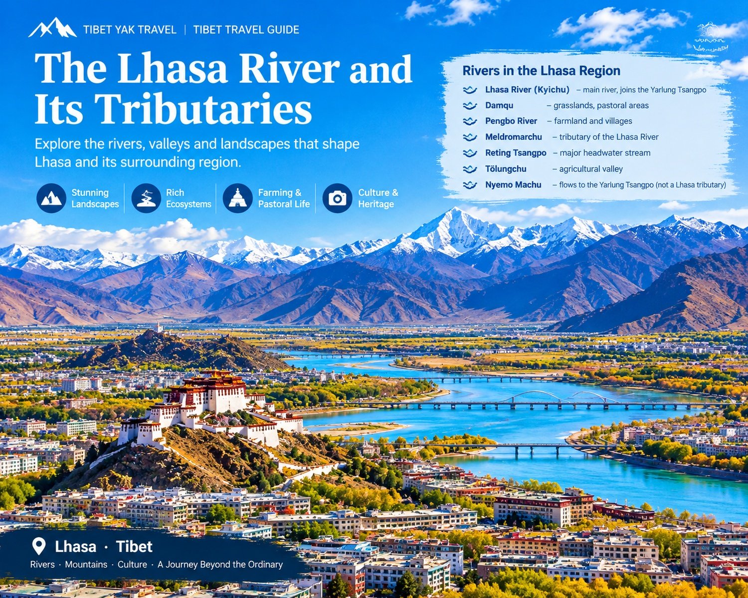
The Rivers of Lhasa: Discover Tibet Beyond the Famous Landmarks
When travelers think of Lhasa, they often picture the Potala Palace, Jokhang Temple, traditional Tibetan streets and the snow-covered mountains surrounding the city. Yet another feature has played an equally important role in shaping the region: its rivers.
The Lhasa River, known in Tibetan as Lhasa Kyichu, flows through the heart of the Lhasa region before joining the Yarlung Tsangpo River near Qüxü (Qushui). Its valley has supported agriculture, settlements, transportation and cultural exchange for centuries. The Lhasa River is approximately 551 kilometers long, with a drainage basin covering about 32,875 square kilometers, according to the Tibet regional government’s water resources authorities. It is the largest tributary of the Yarlung Tsangpo in its middle reaches.
Beyond the main river, the wider region contains a network of tributaries and smaller waterways. These rivers connect high mountain wetlands, grasslands, agricultural valleys and Tibetan communities. Some flow through the fertile countryside of Lhasa, while others belong to neighboring river systems that drain directly into the Yarlung Tsangpo.
For travelers interested in Tibet’s geography, landscapes and traditional rural life, understanding these rivers offers a deeper perspective on the region.
The Lhasa River: Kyichu, the River of Happiness
The Lhasa River is the principal waterway of the Lhasa region and one of the most important rivers in central Tibet. Its Tibetan name is commonly written as Kyichu. The name is traditionally interpreted as the “River of Happiness” or “River of Joy,” reflecting the familiar translation associated with the river in Tibetan cultural and tourism writing.
The river originates in the Nyenchen Tanglha mountain region north of Lhasa, flows southwest through the wider Lhasa valley and eventually joins the Yarlung Tsangpo near Qüxü County.
Geography and natural environment
The Lhasa River has a main channel of approximately 551 km and a drainage basin of roughly 32,875 km². Its watershed extends across parts of the modern administrative areas of Nagqu and Lhasa. Rainfall, seasonal snowmelt and groundwater all contribute to its flow. Research on the basin highlights the importance of these water sources and the effects of seasonal changes on river discharge.
The river’s middle and lower reaches contain relatively broad valleys, fertile farmland and many of the region’s principal settlements. Barley, wheat, rapeseed and other crops are cultivated in suitable areas, while higher elevations support grasslands used for livestock grazing.
The Lhasa River and the city
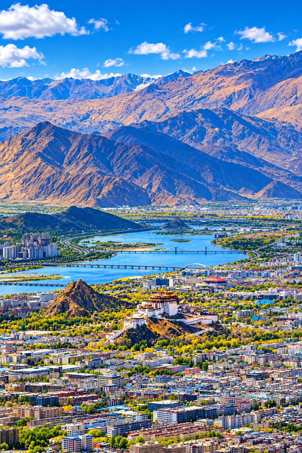
The river passes close to central Lhasa, creating an open landscape of water, mountains and urban development. The riverbanks are popular places for walking, enjoying the scenery and observing local life. In recent years, riverside improvements and tourism projects have added new recreational opportunities.
A riverside sightseeing and cultural entertainment project called Qingman Lhasa River was announced for trial operation beginning September 30, 2025. Its proposed offerings included boat trips and immersive cultural experiences. Travelers should check current local operating information before planning a visit.
Why visit the Lhasa River?
The river offers a different perspective on Lhasa from the city’s historic temples and palaces.
Visitors can enjoy:
- Views of the river beneath Tibet’s wide blue skies.
- Scenic walks along accessible riverside paths.
- Views of bridges, surrounding mountains and modern Lhasa.
- Opportunities to observe waterbirds and the river’s changing seasonal landscape.
- A glimpse of the relationship between water, agriculture and life on the Tibetan Plateau.
For photographers, the contrast between the river, the surrounding mountains and Lhasa’s changing skyline can be particularly appealing.
Damchu: A River of Northern Lhasa County
Damchu, Damxung River in some English-language contexts, is a river associated with Damxung County, north of Lhasa. The Chinese geographical account describes its source as lying on the southern side of Takongba Mountain in eastern Damxung County. The river flows toward the Lachu water system near Mailin.
The surrounding landscape is characterized by high-altitude grasslands and open mountain terrain.
Grasslands and pastoral life
The Damxung region is known for its extensive natural pastures. Tibetan herders raise yaks, yak-cattle hybrids, cattle, sheep and goats in the wider area. These grasslands are part of a traditional pastoral landscape shaped by the short growing season, cold winters and large differences between daytime and nighttime temperatures.
Visitors traveling north from Lhasa toward the grasslands and mountain lakes may encounter landscapes that differ markedly from the more densely cultivated river valley around the city.
Travel tip: Bring warm clothing when exploring the Damxung area. Even during warmer months, temperatures can fall quickly, especially in windy or cloudy weather.
Phenbo River: Water and Agriculture in Lhünzhub County
The Phenbo River, also known in Chinese as Phenbochu, flows through Lhünzhub County, northeast of Lhasa. Its course passes through landscapes that include both natural pastureland and cultivated farmland. According to the geographical account, the river flows generally west to east before turning south toward the Lhasa River.
A landscape of fields and pastures
The upper reaches of the Phenbo River are associated with natural grazing land. Farther downstream, agricultural areas become more prominent.
Farmers in the valley grow crops such as:
- Highland barley
- Wheat
- Rapeseed
- Other locally suitable crops
This combination of pasture and farmland illustrates how river valleys support different forms of livelihood across the Tibetan Plateau.
Why the Phenbo River matters
The Phenbo River is not as well known among international visitors as the Lhasa River, but it forms part of the wider network of waterways supporting rural communities around Lhasa. For travelers interested in agricultural landscapes, traditional Tibetan villages and the countryside beyond the capital, the Phenbo region offers a valuable geographical perspective.
Meldromarchu: The River of Maizho kunggar
Meldromarchu, also spelled Meldro Machu, The river originates in the northern foothills of the Guokala mountain range and flows westward toward the Lhasa River near Maizhokunggar.
Mountain valleys and pastoral landscapes
The river basin contains grasslands used for grazing yaks and Tibetan sheep. The wider area also supports local agriculture and settlements. As the river descends through the mountain landscape, its valley provides water for the surrounding environment and communities.
Exploring eastern Lhasa
Maizhokunggar lies along the eastern approach to Lhasa. The wider area offers views of mountain slopes, rural settlements and open grasslands. Visitors exploring the region can gain a better understanding of how the Lhasa River system connects the capital with the surrounding countryside.
Note: English spellings of Tibetan river names vary across maps and publications. Meldromarchu is one transliteration used in descriptions of the Lhasa River basin.
Reting Tsangpo: A River Connected with Lhünzhub’s Mountain Landscape
Reting Tsangpo, also written as Reting Puchu, is a tributary in the wider Lhasa River system associated with Lhünzhub County.
The Chinese geographical account identifies its source as being in the territory of present-day Jiali County, with its upper reaches known as Maidi Tsangpo.
The river is also associated with natural pastures and agricultural land.
Rivers, monasteries and Tibetan culture
The Reting area is known for its historical religious landscape, particularly Reting Monastery, an important center in the history of Tibetan Buddhism. The river and its surrounding valleys form part of the broader environment in which pastoral communities, farming settlements and religious institutions developed.
Although the river itself is not a major tourist attraction with established visitor facilities, its geographical setting helps explain the connections between mountain watersheds and the cultural landscape of central Tibet. Travelers interested in Tibetan Buddhist history can consider exploring the Reting area as part of a broader journey through the countryside north of Lhasa, subject to road conditions and local access requirements.
Tölungchu: The River of Tölung Dechen
Tölungchu, also written as Tölung River or Tolung Chu, flows through Tölung Dechen District, northwest of central Lhasa. Its name is associated with the Tölung valley. The river originates on the southeastern slopes of the Nyenchen Tanglha range and flows southeast toward the Lhasa River.
A fertile valley northwest of Lhasa
The upper reaches of the Tölungchu basin include natural grasslands used for livestock grazing. Farther downstream, the landscape includes fertile agricultural fields. Crops grown in the wider valley include highland barley, wheat, peas, broad beans and potatoes. This mixture of pastureland and farmland reflects the importance of rivers in supporting rural livelihoods across central Tibet.
Why the Tölungchu is important
The Tölungchu is one of the recognized tributaries of the Lhasa River system. The basin forms part of the wider agricultural and ecological landscape surrounding Lhasa.
For visitors, the district offers a glimpse of rural Tibet beyond the best-known urban attractions.
It is also a reminder that the Lhasa River’s importance extends far beyond the city itself: its tributaries connect many communities and landscapes across the region.
Nyemo Machu: A River Flowing Toward the Yarlung Tsangpo
Nyemo Machu, also known as Nyemo Chu, is associated with Nyemo County, west of Lhasa. Unlike the tributaries described above, which join the Lhasa River system, Nyemo Machu flows southeast toward the Yarlung Tsangpo River. This distinction is important when understanding the geography of central Tibet: not every river in the wider Lhasa region is a tributary of the Lhasa River.
Agriculture and pastoral life
The Nyemo Machu valley contains natural pastures as well as agricultural land. Local communities raise yaks and Tibetan sheep, while cultivated areas support crops such as highland barley, wheat and rapeseed. These landscapes illustrate the close relationship between river water, farming and animal husbandry in Tibet. For travelers visiting Nyemo County, the river forms part of the broader rural landscape rather than a standalone sightseeing attraction.
How the Rivers Shape Life in the Lhasa Region
The rivers of Lhasa are more than geographical features. They support ecosystems, agriculture, pastoral communities and settlements across the region.
Agriculture
Water from the river network helps sustain farmland in the middle and lower reaches of the Lhasa basin. Highland barley, wheat, rapeseed and other crops are grown where the terrain and climate permit.
Pastoralism
Higher elevations and mountain valleys contain natural grasslands used for grazing yaks, sheep and other livestock.
Settlements and transportation
Rivers and their valleys have influenced where communities developed and how people moved between different parts of central Tibet.
Ecology and water management
The Lhasa River basin contains numerous tributaries and supports a range of ecological environments. Government water-management programs emphasize coordinated water allocation, conservation and the protection of river systems. <sup>4</sup>
Lhasa River and Its Tributaries: Quick Reference
| River | Main area | Relationship to the river system |
|---|---|---|
| Lhasa River (Kyichu) | Lhasa and surrounding counties | Main river; joins the Yarlung Tsangpo near Qüxü |
| Damqu | Damxung area | Part of the wider Lhasa River tributary system |
| Phenbo River | Lhünzhub County | Tributary of the Lhasa River |
| Meldromarchu | Maizhokunggar County | Tributary of the Lhasa River |
| Reting Tsangpo | Lhünzhub and neighboring areas | Part of the Lhasa River system |
| Tölungchu | Tölung Dechen District | Tributary of the Lhasa River |
| Nyemo Machu | Nyemo County | Flows toward the Yarlung Tsangpo rather than the Lhasa River |
River names and transliterations vary between Tibetan, Chinese and English sources. This table summarizes the relationships described in the geographical source and should not be treated as a complete hydrological classification of every local stream.
Best Time to Explore the Lhasa River Valley
For most travelers, late spring through autumn offers favorable conditions for exploring the Lhasa region.
May to June: The landscape begins to turn green, and the weather is often suitable for sightseeing and countryside excursions.
July to September: The summer monsoon brings more rainfall, and the river landscape can become greener. Travelers should allow flexibility for weather and road conditions.
September to October: Autumn often brings clear skies and excellent visibility, making it a rewarding season for photography and overland travel.
Winter: The region can be very cold, especially outside the city. The river and surrounding mountains may offer a quieter atmosphere, but visitors should prepare for low temperatures.
Weather varies by elevation and location, so conditions in Damxung or the upper river valleys may differ considerably from those in central Lhasa.
How to Include the Lhasa River in Your Tibet Itinerary
The easiest way to experience the Lhasa River is to combine riverside sightseeing with visits to Lhasa’s historic landmarks.
A suggested cultural itinerary is:
- Day 1: Explore the Potala Palace and central Lhasa.
- Day 2: Visit Jokhang Temple and Barkhor Street, then enjoy the Lhasa River and its surrounding landscape.
- Day 3: Explore the countryside around Lhasa or take an excursion toward the northern grasslands, depending on road conditions and your interests.
Travelers with more time can explore the wider river basin, including rural areas around Lhünzhub, Maizhokunggar and Tölung Dechen.
Access to particular valleys and attractions can depend on current local regulations, weather and road conditions. Plan rural excursions with a knowledgeable local operator.
Frequently Asked Questions
What is the Tibetan name for the Lhasa River?
The Lhasa River is commonly known in Tibetan as Kyichu or Jichu. Its name is traditionally translated as the River of Happiness or River of Joy.
How long is the Lhasa River?
The Lhasa River is approximately 551 kilometers long, with a drainage basin of about 32,875 square kilometers according to the Tibet regional government’s water resources authorities.
Where does the Lhasa River begin and end?
The river originates in the Nyenchen Tanglha mountain region north of Lhasa. It flows southwest through the wider Lhasa region and joins the Yarlung Tsangpo near Qüxü County.
Which rivers are tributaries of the Lhasa River?
Important tributaries include Meldromarchu, Tölungchu, Pengbo River and other waterways in the basin. Damqu and Reting Tsangpo are also associated with the wider tributary system.
Does Nyemo Machu flow into the Lhasa River?
No. The geographical account describes Nyemo Machu as flowing southeast into the Yarlung Tsangpo River.
Can tourists visit the Lhasa River?
Yes. Visitors can enjoy the river scenery around Lhasa, explore accessible riverside areas and check for locally operated sightseeing or boat experiences. Availability and operating schedules should be confirmed before visiting.
Why is the Lhasa River important to Tibet?
The river supports agriculture, rural settlements, ecosystems and water resources in central Tibet. Its valley has long been an important part of the region’s economic and cultural geography.
Discover the Rivers and Valleys of Tibet
The Lhasa River and its tributaries reveal a side of Tibet that many visitors overlook. Beyond the palaces, monasteries and famous mountain landscapes lies a network of waterways connecting high-altitude grasslands, fertile fields and traditional communities.
From the main channel of Kyichu to the rural valleys of Pengbo, Maizhokunggar and Tölung Dechen, these rivers help explain how people have lived and traveled across central Tibet for generations.
For travelers who want to understand the region beyond its famous landmarks, exploring the rivers of Lhasa is an invitation to discover the natural landscape that sustains the city and its surrounding communities.
Plan your Tibet journey with Tibet Yak Travel and explore Lhasa’s history, landscapes and living culture with local Tibetan experts.



[…] Lhasa River (Kyichu): Flows through the Lhasa area before joining the Yarlung Tsangpo near Qüxü County. […]